
You can now explore Antarctica’s vast ice sheets and dynamic changes through advanced satellite imaging, which captures detailed surface features and monitors shifts in ice thickness and glacier movement. These space-based technologies track temperature variations, ice melt rates, and snowfall patterns in real time, providing critical data for understanding climate impacts. This all-encompassing view also supports global research and environmental decision-making, offering insights you’ll find useful as you continue to uncover how this frozen continent evolves.
Satellite Imaging Technologies Transforming Antarctic Exploration
Although Antarctica’s extreme conditions have long limited direct observation, satellite imaging technologies have revolutionized how researchers study this remote continent. You can now rely on satellite innovations that offer consistent, high-resolution data regardless of harsh weather or darkness.
Remote sensing allows you to collect detailed information about Antarctica’s surface features and environmental changes without physically being there. These technologies use various sensors to detect different wavelengths of light and electromagnetic signals, providing insights into landforms, temperature variations, and atmospheric conditions.
Mapping Ice Sheets and Glacial Movements From Orbit
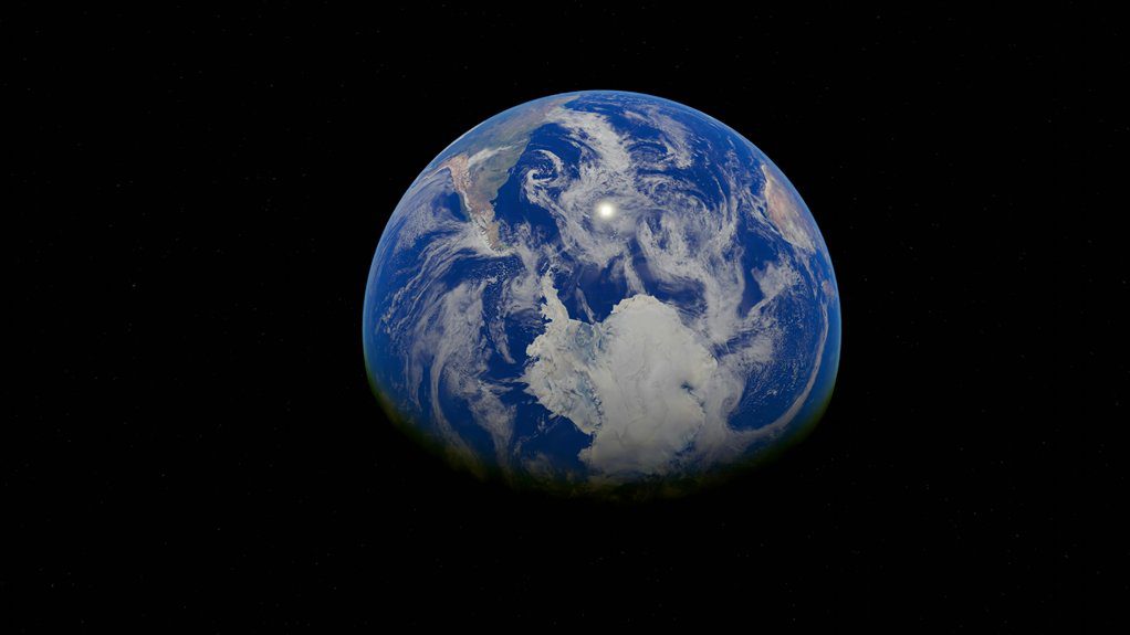
Satellites provide essential data for mapping Antarctica’s ice sheets and tracking glacial movements over time. You can observe ice sheet dynamics by analyzing satellite images that reveal changes in thickness, flow rates, and surface elevation.
These observations help you understand how ice masses respond to environmental factors. By monitoring glacial retreat, satellites detect shifts in glacier boundaries and melting patterns, offering a clear picture of ice loss.
Advanced radar and laser altimetry techniques allow precise measurement of ice surface changes, even in harsh weather. Using this orbital data, you can create detailed maps that track the movement and transformation of ice sheets, which is crucial for predicting future behavior.
This method provides consistent, large-scale coverage that ground observations alone can’t achieve efficiently.
Monitoring Climate Change Effects on Antarctica in Real Time
Building on the ability to map ice sheets and glacial movements, real-time monitoring lets you observe how climate change directly affects Antarctica’s environment as it happens.
You can track temperature shifts, ice melt rates, and snowfall patterns continuously, which reveals significant climate feedbacks influencing global systems. This immediate insight helps identify ecosystem changes, such as variations in sea ice extent affecting marine habitats and species distributions.
Real-time data also highlights how atmospheric and oceanic conditions interact, accelerating or slowing changes on the continent. By watching these developments live, you gain a clearer understanding of Antarctica’s dynamic response to warming trends.
This knowledge supports timely decision-making and enhances scientific models predicting future climate scenarios, making your observations essential for grasping the ongoing impacts of climate change on this remote region.
The Role of Space-Based Observations in Global Environmental Research
When you rely on space-based observations, you gain a thorough and consistent view of Earth’s environmental systems that ground-based methods alone can’t provide.
Satellites monitor Antarctica’s ice sheets, atmospheric conditions, and ocean temperatures, delivering data essential for understanding global warming. This information helps you track changes over time, revealing patterns that influence climate models worldwide.
You can use these insights to evaluate the effectiveness of environmental policies aimed at mitigating climate impacts. Space-based tools also allow you to coordinate international research efforts by sharing accurate, up-to-date data across borders.
Ultimately, these observations enable you to make informed decisions about protecting fragile ecosystems and adapting strategies for a changing planet. Without this global perspective, responding effectively to environmental challenges would be far more difficult and less precise.
Frequently Asked Questions
How Do Researchers Prepare for Antarctic Field Expeditions?
You plan expedition logistics carefully, ensuring supplies and transport are reliable. You follow strict safety protocols, including training for extreme conditions and emergency response, so you stay prepared and protected during your Antarctic field expeditions.
What Wildlife Species Inhabit the Antarctic Region?
You’ll find several penguin species like emperor and Adélie penguins thriving there, along with diverse seal populations including Weddell and leopard seals. These creatures adapt amazingly to Antarctica’s harsh, icy environment.
What Historical Expeditions Contributed to Antarctic Exploration?
You’ll find early explorers like Shackleton and Scott led notable expeditions that mapped Antarctica’s coasts. Their daring journeys paved the way for modern research, revealing the continent’s mysteries despite harsh, frozen conditions.
How Do Extreme Weather Conditions Affect Human Activity in Antarctica?
Extreme weather challenges in Antarctica force you to adapt constantly, testing your limits. You’ll rely heavily on human resilience, using specialized gear and strategies to survive and work effectively despite freezing temperatures and fierce winds.
What International Treaties Govern Antarctic Research and Preservation?
You rely on the Antarctic Treaty System for Antarctic governance, which guarantees peaceful research and environmental protection. Its treaty significance lies in promoting international cooperation and preserving Antarctica’s unique ecosystem for future scientific discovery and global benefit.